
Surveying Laboratory
In this laboratory, students will learn to measure and calculate heights, depths, relative positions, property lines, and other characteristics of terrain. They will also determine longitudes and latitudes of important features and boundaries in survey areas using total station, levels, and satellite-based global positioning systems (GPS). After collection and recording of information in field, they will process and analyze data to estimate the coordinates and their accuracy measures. The processed data with known accuracy will be used to determine shape and contours of terrain above and below ground to map boundary markers. These measurements are further used in various projects to plan roadways and tunnels, build pipelines and bridges, track the movement of pollutants in waterways and determine ocean floor erosion rates after storms and earthquakes
In above learning sequence, they will plan ground surveys, develop criteria for survey methods and procedures, conduct surveys to establish legal boundaries for properties, establish fixed points for use in making maps, prepare all data, charts, plots, maps, records, and documents related to surveys, perform adjustments computations, verify the accuracy of survey data including measurements and calculations conducted at survey sites, write descriptions of property boundary surveys, and develop criteria for the design and modification of survey instruments.
The following facilities are available in the Surveying laboratory
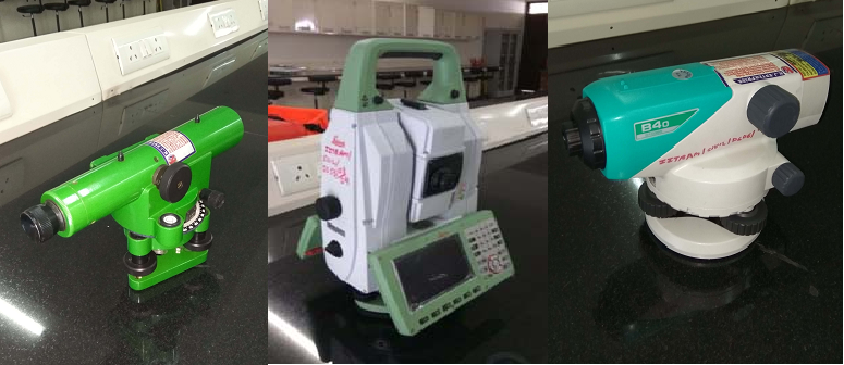
1. Sokkia Auto level
2. Global Positioning System (G.P.S)
3. Dumpy Level
4. Mirror Stereoscope
5. Vernier transit Theodolite with stand
6. Planimeter (Manual)
7. Plane Table with Accessories
8. Total Station